Percentage of construction completed
Updates
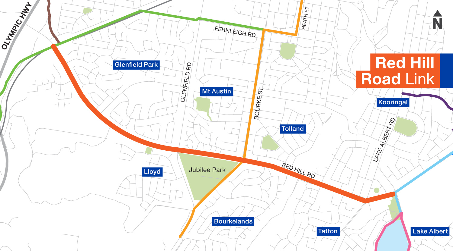
Map

Frequently asked questions
What does $15.8 million buy?
A 56 km network of safe cycling routes providing a direct, healthy and active commute to school, shops, work and recreation.
The project funding is:
Stage 1: $12.81 million ($11.35 million NSW Government + $1.45 million Council)
Stage 2: $3.92 million ($3.8 million NSW Government + $130 thousand Council)
What is the schedule and time frame for the works?
The planned schedule for the construction of cycle paths is:
- Eastern Levee link
- Bourke link
- Kooringal Road link
- University link
- Red Hill Road link
- Kapooka link
- Central, Wollundry, Morgan links
- Forest Hill link
- Fay Avenue link
- Lake Albert link
- Pomingalarna link
What will the paths be constructed from?
The nature of works will depend on the existing conditions along the selected route, and may involve:
- resurfacing or widening of existing pathways
- separated on-road cycle paths within existing roadways,
- intersection upgrades
- new 2.5 - 3 metre wide concrete and asphalt pathways.
What are end-of-trip facilities and where will they be located?
Two amenities and bike storage areas will be constructed near the Visitor Information Centre in Tarcutta Street and the Oasis Regional Aquatic Centre in Morgan Street.
The facilities will support people who want to cycle into the business district rather than driving or taking public transport. Features include a toilet and shower area, lighting, wall mounted bike racks, enclosed bike lockers, bicycle maintenance station, e-bike charging stations and a water drinking station.
The lockable facility will have electronic swipe access and CCTV will enhance security in the area.
Will Council rezone or acquire any land?
There will be no land acquisition or rezoning. Where Council does not own the land, negotiations are underway with affected landholders for right of way.
Will my driveway or the parking in front of my house be affected?
The proximity of houses and businesses to cycle path infrastructure differs across each route. Check the individual maps for detailed information.
What about safety education?
Council is working in partnership with RMS to develop a safe road user education program which includes cyclists, pedestrians and motorists. The cycle paths are designed for use by cyclists, motorised scooters, wheelchairs and pedestrians.
Why is the Forest Hill route not utilising the disused rail corridor?
The rail corridor is owned by the NSW Government and an Act of Parliament must be passed to allow usage. This is time prohibitive for this project as it must be completed within a timeframe stipulated by the funding agreement.
Rail trail pilot project sites commissioned by the NSW Government are under construction in Tumbarumba and Lismore.
Why is some land adjacent to the rail line being used, but not other land?
Where possible, Council has entered into agreements with land owners to lease relevant parcels of land immediately adjacent to the rail corridor.
What’s in it for me if I don’t ride a bike?
- The paths will offer a safe, accessible option to everyone in the community to move around the city, regardless of ability. For example, community members using motorised scooters and wheelchairs will have the opportunity to safely navigate the city, enabling them to access recreational spaces and the outdoors.
- Ramps will provide access to the levee bank and Wiradjuri Walking Track
- Provide a safe alternative for children to travel to and from school with minimal interaction with traffic
- Reduced traffic congestion and fewer cars on the city’s roads
- Fewer cars mean reduced emissions and improved air quality
Notifications
No notifications to show.
Images