Climate change will affect areas around Australia and the world differently. Some places may experience greater weather and temperature extremes than others. Knowing how climate change will impact our region will help us to plan for our future.

Climate change predictions for Wagga Wagga
What we expect to see in our region:
- Increases to both minimum and maximum temperatures throughout the year
- More frequent heatwaves that last longer
- Experience fewer cold nights
- A shift from when we experience rainfall, with less rain in spring and more rain in autumn
The NSW Government has developed the Murray Murrumbidgee Climate change snapshot providing information about how climate change will affect our region.
The following are major effects of climate change:
A bushfire is an unplanned vegetation fire that is a natural and complex part of the Australian environment. Bushfires are an important part of the bushland cycle as it produces heat, smoke and ash that can stimulate seeds to germinate.
Bushfires can be started by natural causes such as lighting strikes, or by people accidently or on purpose. Weather conditions and fuel load conditions play a part in bushfires severity. Hot, dry and windy weather can contribute to fire danger.
The Forest Fire Danger Index (FFDI) is used in NSW to quantify fire weather, which combines observation of temperature, humidity, wind speed and an estimate of the fuel state. The Bureau of Meteorology issues Fire Weather Warnings when the FFDI is forecast over 50.
The Murray Murrumbidgee region is projected to experience an increase in average and severe FFDI values in the near future and far future in summer and spring months.
The increased FFDI will impact on the Wagga Wagga community by:
- Increase risk to loss of life, injuries
- Increase risk of severe health impacts from air pollution
- Increase risk to mental health
- Damage to destruction of homes, businesses, schools, childcare facilities, infrastructure, assets, or services
- Loss of native wildlife and habitat
- Water pollution
Visit the NSW Rural Fire Service website for information on creating survival plans, preparing your home and family, and fire danger ratings.
Bushfire prone land mapping can be found at via Council's Online Mapping Portal.
Storms and flood are a natural part of the NSW climate. They bring valuable rainfall and water to part of the state, yet they can have severe impacts on people, businesses, or environments.
In NSW, floods are predicted to increase in frequency along the coast of NSW with the progression of climate change. These factors include changes in daily rainfall and increase rainfall intensity, as a result of projected increases in mean and daily temperatures.
The Murrumbidgee River has flooded on a number of occasions, causing flood damage and inconvenience to Wagga Wagga. Since the first rural settlement in the early 1840s there have been 77 floods of over 8.23m.
Construction to raise the Murrumbidgee River levee system in Wagga Wagga started in October 2017 and completed in March 2020, giving residents a 1 in 100year level of protection against flooding.
Impacts of Storms and Floods
Changes in rainfall patterns have the potential for widespread impacts. Seasonal shifts in rainfall can impact:
- Increase risk to loss of life, injuries
- Increase risk of severe health impacts from air pollution
- Increase risk to mental health
- Damage to destruction of homes, businesses, schools, childcare facilities, infrastructure, assets and services
- Loss of native wildlife and habitat
- Water quality impacts
- Changes to river flow
- Harm to agricultural productivity
- Disruption to supply chain
For information on flooding visit Council's Flooding webpage
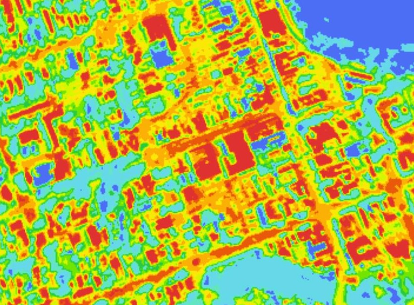
Urban areas where built structures are most common are prone to higher temperatures relative to outlying areas. These hotter areas are referred to as ‘urban heat islands’.
The difference in temperature between urban and less developed areas has to do with how well the surfaces in each environment absorb and hold heat. Urban heat islands can form under a variety of conditions, including during the day or night, in large or small cities and suburban areas.

Urban heat islands impact a number of factors including:
- Increase risk of heat stress and dehydration
- Damage to infrastructure through heat stress
- Increased energy used to cool buildings
A simple way to combat urban heat islands is to incorporate ‘green infrastructure’ such as tree canopy, vegetated roofs, walls and waterways. The green infrastructure reflects the heats, providing shade and releases water into the atmosphere, decreasing the temperature.
Wagga Wagga City Council has a strategy for reducing the effects of urban heat called the Urban Cooling Strategy 2022-2025. The strategy aims to increase community health, well-being and resilience through planning more sustainable future developments and adapting our existing areas wherever possible.
Climate change is projected to impact Wagga Wagga in numerous ways, leading to potentially unforeseen risks to the built environment and council’s assets. The Resilience Blueprint for South-East NSW provides both operational and future recommendations that help to manage risks appropriately, ensuring the climate resilience of these assets into the future.
